
Photographer: Lenny G
Online Resources

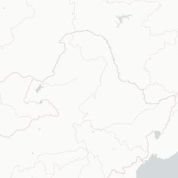
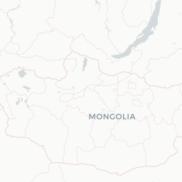
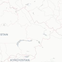
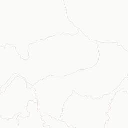
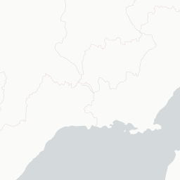
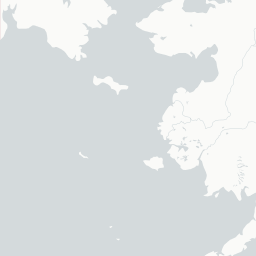
Occurrence records map (6 records)


Datasets
2 datasets have provided data to the Atlas of Living Australia for this species.
Browse the list of datasets and find organisations you can join if you are interested in participating in a survey for species like Laxotela holstoni
Types
Specimens
Images


Misidentified

Names and sources
| Accepted Name | Source |
|---|---|
| Laxotela holstoni |
|
| Name | Source |
|---|---|
| Laxotela holstoni accepted |
|
| Identifier | Source |
|---|---|
| https://biodiversity.org.au/afd/taxa/1a3dd04a-fd4f-4767-b7bf-c84cc340b019 Taxon Concept current |
|
| https://biodiversity.org.au/afd/taxa/4240b6d9-a060-4759-96af-ff37c180ce38 Scientific Name current |
|
| https://biodiversity.org.au/afd/taxa/1a3dd04a-fd4f-4767-b7bf-c84cc340b019 Taxon current |
|
| urn:lsid:biodiversity.org.au:afd.taxon:1a3dd04a-fd4f-4767-b7bf-c84cc340b019 Taxon LSID unknown |
|
| http://biodiversity.org.au/afd/taxa/1a3dd04a-fd4f-4767-b7bf-c84cc340b019 Taxon unknown |
|
Classification
- kingdom
- ANIMALIA
- phylum
- ARTHROPODA
- subphylum
- HEXAPODA
- class
- INSECTA
- informal
- Pterygotes
- order
- DIPTERA
- suborder
- BRACHYCERA
- informal
- Orthorrhapha
- superfamily
- ASILOIDEA
- family
- THEREVIDAE
- subfamily
- Agapophytinae
- genus
- Laxotela
- species
- Laxotela holstoni
View list of all occurrence records for this taxon
(6 records)
View map of all occurrence records for this taxon
(6 records)
Charts showing breakdown of occurrence records (6 records)
Name references found in the Biodiversity Heritage Library
| Data sets | Licence | Records |
|---|---|---|