Search for PLATYSACE+SP.+(MT+NINDERRY+P.R.SHARPE +2092) returned 603 results.
Refine results
Refine results
Section
- Site Page (144)
- Biodiversity Science project (140)
- Species (119)
- Common Name (105)
- Locality (71)
- Support article (15)
- Region (5)
- Data provider (2)
- Data resource (2)
Taxonomic rank
- Species (103)
- Unranked (7)
- Variety (5)
- Genus (2)
- Subspecies (2)
Image available
- Yes (140)
Lifeforms
- Fish (16)
- Insects and Spiders (10)
- Reptiles (4)
- Molluscs (3)
- Amphibians (1)
- Birds (1)
Taxonomic status
- Accepted (88)
- Heteroptypic Synonym (15)
- Synonym (11)
- Misapplied (3)
- Homotypic Synonym (1)
- unreviewed (1)
Conservation status in Australia
- Extinct (1)
Conservation status in QLD
Conservation status in VIC
- Endangered (4)
Conservation status in SA
- Rare (1)
- Vulnerable (1)
Conservation status in WA
Conservation status in NT
- Vulnerable (1)
-
Biodiversity Science project: SGEM Vienna Art 2018, Scientific Conference on Social Sciences a
The International Scientific Conference SGEM Vienna 2018 is organized as an extended sessions of the SGEM International Scientific Conferences on SOCIAL SCIENCES and ARTS. The event will be held in the biggest and most historically rich HOFBURG Imperial Palace, Vienna, Austria in the period of 19-22 March, 2018...

-
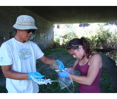
Biodiversity Science project: Water Quality Monitoring
Dinoflagellates emitting bioluminescence make us happy. It means San Diego’s water does not have harmful levels of toxic chemicals that can harm plants, fish and bugs. And it’s one of the tests we conduct during our monthly water quality monitoring events. Coastkeeper has monitored San Diego’s waterbodies since 2000. We use the data collected by our volunteers to identify polluted waters and reduce sources of pollution...
-
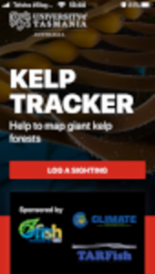
Biodiversity Science project: Kelp Tracker
OzFish Unlimited and TARFish have partnered with the Institute for Marine and Antarctic Studies (IMAS) at the University of Tasmania to harness the local knowledge and expertise of fishers, boaters, divers and paddlers to help monitor Tasmania’s disappearing and endangered giant kelp forests. Kelp Tracker is part of a research project that invites waterway users to share (or ‘log’) their sightings of endangered and disappearing giant kelp (Macrocystis pyrifera) in Tasmania...
-
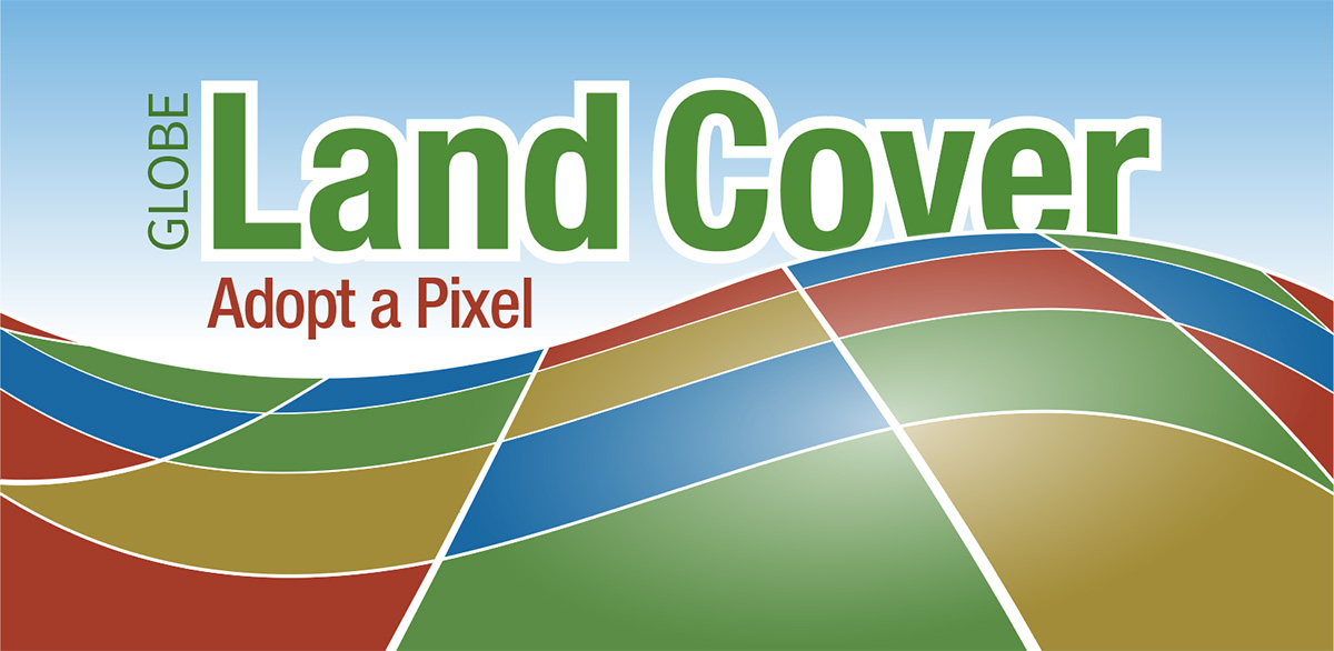
Biodiversity Science project: GLOBE Observer: Land Cover
Land cover describes what you see on the surface of the land such as trees, grass, pavement, or bare rocks or soil. Even though land cover is familiar to everyone on the planet, the most detailed maps of global land cover are still on the order of hundreds of meters [about 330 feet] per pixel. That means that a park in a city may be too small to show up on the global map...
-
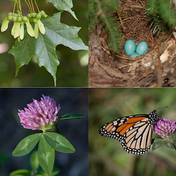
Biodiversity Science project: Vermont Atlas of Life on iNaturalist
From birds to butterflies and everything in between, your biodiversity sightings can make a difference. Join our growing community of citizen naturalists from around the Green Mountain State in discovering and sharing observations of Vermont life. Your observations can be turned into research-grade, citizen science data that will help us discover, track and ultimately conserve our natural heritage. It started with a simple question...
-
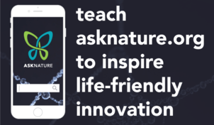
Biodiversity Science project: Teach asknature.org to identify causal relationships in nature
AskNature.org is making it easier for people to share and organize biological literature so that it can be used to inspire innovators around the world as they search for resilient and regenerative solutions this century's greatest challenges. You can help by training a new learning algorithm to identify organism names and causal relationships from the abstracts of peer reviewed literature that describe how organisms and other living systems survive and thrive on Earth...
-
Biodiversity Science project: River Assessment Field Team
Do you enjoy way finding and trail blazing adventures? Volunteer with The San Diego River Park Foundation's River Assessment Field Team to perform reconnaissance on different segments of the San Diego River! By volunteering to document river threats, you can be a citizen scientist and help improve the future of our river...
-
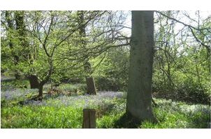
Biodiversity Science project: Track a Tree
Are you are a regular visitor to your local woodland? If so, Track a Tree needs your help to record the spring timing (or phenology) of the UK’s woodland trees and the flowering plants that grow beneath them. Track a Tree aims to find out how much woodland species vary their seasonal timing, and how tree leafing affects the flowering of plants on the woodland floor...
-
Support article: What is data licensing?
Put simply, licensing is granting certain rights to others to allow them to use your work. You do not give up ownership of your information by doing this (unless you specifically release your work into the public domain e.g. with a CC0 'no rights reserved' license); you just allow others to use it for their own research and analysis. In relation to the ALA, you may need to grant the ALA and its users, a license to use your data...
-
Support article: Flickr images
Note: This guide refers to version 2.0 of the spatial portal. Map images were supplied by Panoramio in previous versions of the spatial portal. Flickr is a free service that allows you to upload, view and map spatially registered images (images that have be geolocated: given a latitude and longitude). The Spatial Portal of the ALA uses the Flickr web services to tap and display any available images with a location within the displayed map window...