Search for Phasianella australis returned 4,715 results.
Refine results
Refine results
Section
- Species (3,458)
- Site Page (621)
- Data resource (322)
- Biodiversity Science project (159)
- Institution (50)
- Support article (39)
- Common Name (21)
- Data provider (21)
- Species list (12)
- Spatial layer (8)
- Collection (4)
Taxonomic rank
- Species (1,868)
- Unranked (1,149)
- Variety (271)
- Subspecies (150)
- Form (12)
- Genus (3)
- Subvariety (2)
- Infraspecific Name (1)
- Species Group (1)
- Subgenus (1)
Image available
- Yes (532)
Lifeforms
- Insects and Spiders (543)
- Crustaceans (105)
- Molluscs (101)
- Fungi (85)
- Fish (52)
- Birds (27)
- Mammals (13)
- Reptiles (12)
- Amphibians (2)
Taxonomic status
- Accepted (1,507)
- Synonym (1,293)
- Heteroptypic Synonym (281)
- Homotypic Synonym (213)
- Misapplied (55)
- Miscellaneous Literature (36)
- unreviewed (32)
- Pro-parte Synonym (15)
- unreviewedSynonym (12)
- Excluded (9)
- Inferred Accepted (2)
- Subjective Synonym (2)
- Inferred Unplaced (1)
Conservation status in Australia
- Endangered (10)
- Vulnerable (10)
- Critically Endangered (3)
Conservation status in ACT
- Endangered (1)
- Vulnerable (1)
Conservation status in NSW
- Vulnerable (7)
- Endangered (6)
- Critically Endangered (1)
- Extinct (1)
Conservation status in QLD
- Vulnerable (6)
- Endangered (4)
- Near Threatened (2)
Conservation status in VIC
- Endangered (10)
- Critically Endangered (7)
- Vulnerable (5)
Conservation status in TAS
- Endangered (6)
- Rare (6)
- Extinct (1)
- Vulnerable (1)
Conservation status in SA
- Rare (7)
- Vulnerable (5)
- Endangered (4)
Conservation status in WA
- Endangered (4)
- Critically Endangered (3)
- Priority 1: Poorly-known species (3)
- Priority 3: Poorly-known species (3)
- Priority 4: Rare, Near Threatened (3)
Conservation status in NT
- Endangered (3)
- Vulnerable (1)
-
Biodiversity Science project: Bristle Whistle
Together we can find a very sneaky, endangered, ancient species of Australian songbird called Eastern bristlebird by review acoustic recordings online to listen for their sweet serenades...

-
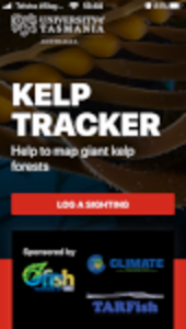
Biodiversity Science project: Kelp Tracker
OzFish Unlimited and TARFish have partnered with the Institute for Marine and Antarctic Studies (IMAS) at the University of Tasmania to harness the local knowledge and expertise of fishers, boaters, divers and paddlers to help monitor Tasmania’s disappearing and endangered giant kelp forests. Kelp Tracker is part of a research project that invites waterway users to share (or ‘log’) their sightings of endangered and disappearing giant kelp (Macrocystis pyrifera) in Tasmania...
-
Biodiversity Science project: Mildew Mania
Curtin University would like to invite schools to help with an ongoing citizen-science research project aimed at protecting West Australia’s barley and wheat crops from the damaging effect of powdery mildew disease. In WA, this disease causes the most economic impact on barley and wheat. Barley powdery mildew costs Australian farmers over $100 million annually through chemical control and lost yield and is a major concern for the future of farming...

-
Support article: Data on the ALA
Jump to section: Types of data Specimen data Observation data Summary of data Data sources Types of data The ALA hosts a wealth of biodiversity data including specimen and observation data. Specimen data Specimen data is often an organism, photograph, sound, or other multimedia file of a species that has been scientifically collected by, and managed in, a natural history collection, a museum or herbarium...
-
Support article: Spatially valid flag
What makes a record spatially valid? What has changed in 2021? Detailed comparison How is the flag used? Search interface: default ALA General data profile Search interface: customising filters Directly querying the API Downloads What else do we check for? Occurrence records in the ALA can be filtered by using the spatially valid flag. This flag combines a set of tests applied to the record to see how reliable are its spatial data components...
-
Support article: Downloading ALA data
Jump to section: How to download a map How to download records Data formats Occurrence records DOI Species checklist Species field guide FAQs Wait time Reviewing past downloads Here we’ll walk you through a few ways to download and save data from the Atlas of Living Australia. The data on the ALA comes in different formats and therefore downloading and saving what you want can look a little different for each datatype...
-
Support article: Flagging an issue with a record
Jump to Section: Background How to flag a record Background Large-scale biodiversity data repositories may contain incorrect data, whether that be from accidentally misidentified species or from general mistakes in data entry. The Atlas of Living Australia (ALA) uses automatic cleaning and filtering mechanisms during data ingestion...
-
Support article: Search by location
Jump to section: Explore your area Explore regions Spatial search I saw a plant/animal, but I don't know what it is! There are a few different ways to search by location in the Atlas of Living Australia. The most used is “Explore your Area”, but there are other options, including “Explore regions” and “Spatial search” which you might find useful. Searching by location rather than by species can be useful for a few different reasons: 1...
-
Support article: Scatterplot
Please note: this guide has been written in relation to version 2.0 of the spatial portal due to brought into production in 2019. A different version of the portal will allow similar functions with some small differences in the user interface. If you are unable to access a required function, please contact support@ala.org.au. The scatterplot function links the sampled values of any two environmental variables on a species (or genus etc) with the map...
-
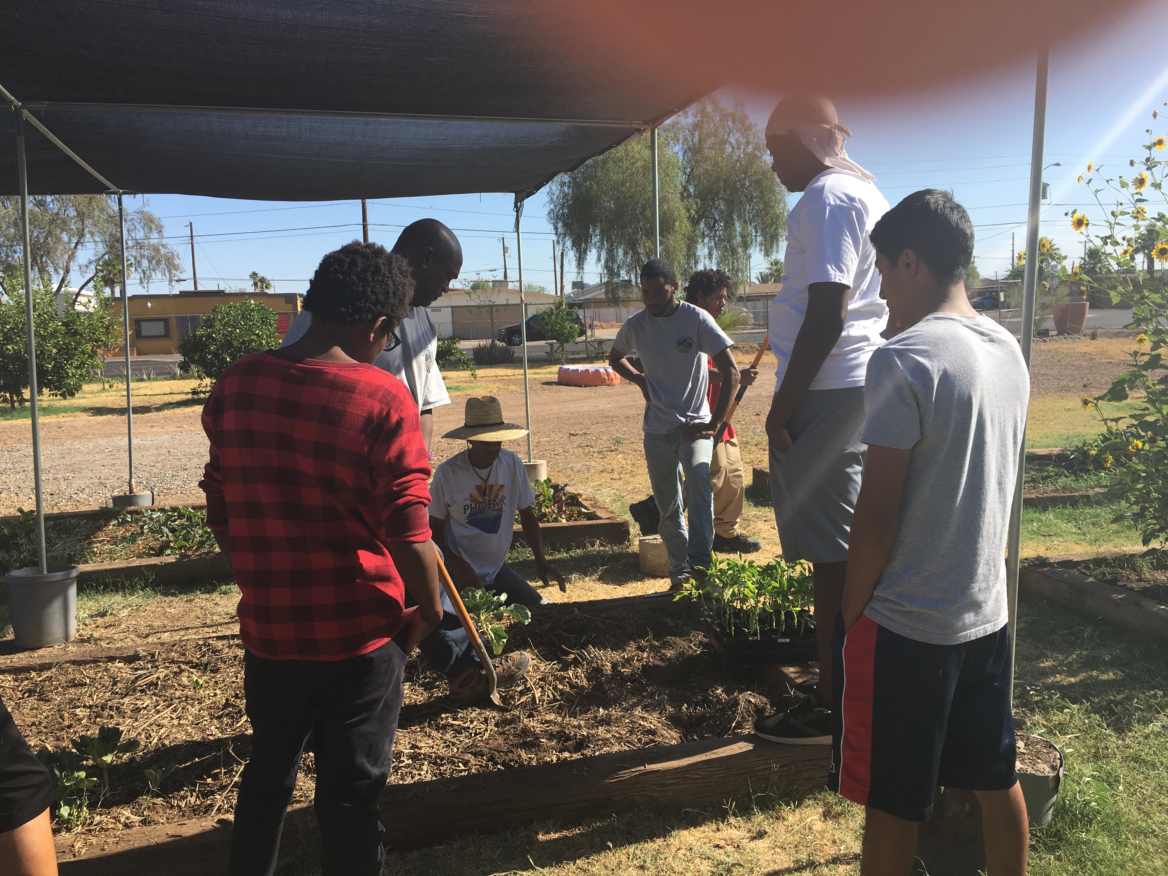
Biodiversity Science project: Urban food gardening
The long term research goal of this project is to understand the changing structure and function of the varied forms of agriculture, and the services it provides in the rapidly urbanizing Central-Arizona Phoenix (CAP) region. The specific goal for this citizen science component is to collect data on the diversity of home and community gardens in Maricopa County, which roughly covers the Phoenix metropolitan region. Recently there has been a lot of enthusiasm around “growing your own food...